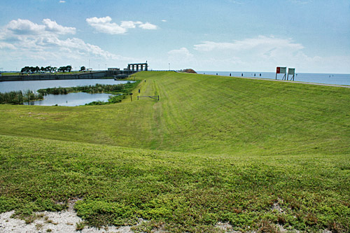
With growing anticipation I approached the town of Moore Haven in central Florida, where I expected to catch my first glimpse of Lake Okeechobee. As the second largest freshwater lake lying completely within the United States, Okeechobee ranks among the most famous landmarks of Florida. I negotiated a long curve into town, watching for the lake to emerge on my left. Nothing. No water, no view. Just a giant, grass-covered berm rising 20 feet above the highway. My stomach flip-flopped. Surely the lake was not being held back by this mound of dirt? As if mocking me, the berm followed me around the southern shore. By the time I had passed through Moore Haven, Clewiston, South Bay, and Belle Glade, it became clear that the highway would afford no view of the lake. At various spots, signs pointed to Okeechobee trailheads, but I was expected in West Palm Beach and had no time to explore. Besides, the thought of millions of gallons of water lapping at the top of that behemoth berm, just waiting for an opportunity to break free and sweep me away, was unsettling to say the least.

The next day, having finished my business on the east coast, I headed back home, determined to delve further into the mystery of the missing body of water. Lake Okeechobee emerged approximately 6,000 years ago when receding seas revealed the Florida peninsula and the shallow depression that became the lake. Since that time, Okeechobee has been the liquid heart of south Florida. Although shallow (its average depth is nine feet), the lake holds enormous amounts of water. Each year it captures billions of gallons of rainwater during the summer rainy season. With no natural outlets, Okeechobee historically overflowed its southern rim, sending a miles-wide sheet of fresh water south and helping to create the Everglades.
There is evidence that Native American tribes settled close to the lake some 4,000 years ago; in fact, the word Okeechobee is the Seminole word for “Big Water.” For centuries, Native Americans coexisted with the ebb and flow of the lake, living close to the water’s edge during times of drought and moving to safer ground during flooding. It wasn’t until settlers began moving in that problems emerged. Gradually, much of the area wetlands were drained and uplands were created. Mile upon mile of citrus groves and sugar cane were planted, homes were built, and towns sprung up around the lake. All was well until 1926, when hurricane force winds thrashed the town of Moore Haven with a wall of water that killed 400 people. Two years later, a second hurricane struck, killing nearly 2,000 people in the young communities of Pahokee, Belle Glade, South Bay, and Lake Harbor.
As a result of these tragedies, Florida requested Federal assistance to develop a flood control system. The solution was a dike, which was begun in 1932 and constructed around the entire 140-mile perimeter of the lake over the ensuing five years. Named in honor of the President who authorized funds for its construction, the Herbert Hoover Dike was designed and built to accepted standards of the time. Hydraulic dredges scooped pervious shell, rock and gravel from the shoreline, mounding the material on the existing pervious foundation of sand, shell, and limestone. Today, these construction methods would not be acceptable, since we better understand material properties and seepage mechanisms.

Although the dike has not failed in 70 years, it erodes internally, allowing a process called piping, in which small tunnels or pipes are formed inside the earthen berm. These pipes carry water and materials, creating leaks over time. So, while it is doubtful that the lake would ever crest the dike (can you hear me breathe a sigh of relief?) there is great concern about leaking at its base, and the higher the level of the lake, the more pressure at the base. Experts believe the risk of a breach increases significantly any time the lake level rises above 18 feet. In 1995, water rose to an elevation of 18.6 feet; the dike showed substantial distress but did not breach, although inspection teams discovered excessive seepage, piping, and even sinkhole formation on the dike’s crest. Again in 1998 the lake rose above 18 feet; the dike stood fast but overall conditions began to worsen.
Though there has long been agreement that the dike needs to be repaired and strengthened, debate over the source of funds and best construction methods stymied any real progress until Hurricane Katrina ripped through Louisiana, causing dikes to fail and incurring millions of dollars in property damage and tragic loss of life. Florida officials immediately implemented new practices, lowering the level of Okeechobee to below average ground level prior to the start of each hurricane season and maintaining the lake at a level of 12 to 12.5 feet throughout the year. Even so, extreme rainfall, such as what we have been experiencing this summer, can cause the lake to fill six times faster than waters can be released.
Fortunately, a rehabilitation plan has finally been adopted and construction is underway on the three highest risk areas of the dike, with the entire project scheduled for completion by 2030. The new and improved dike will be able to withstand a 26-foot water elevation – something that is only expected to occur once in a 935 year period.

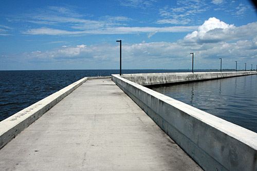
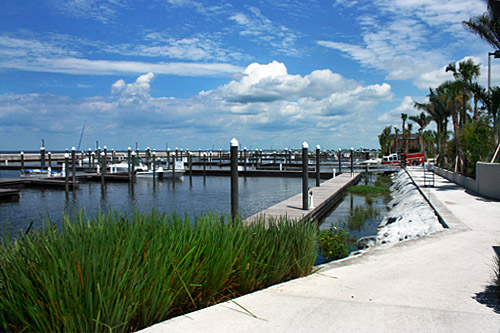
I did finally see the lake. Rather than retracing my earlier route, I diverted around the eastern shore on my way home, as this is the only area where visitors can cross the dike and see a direct view of the lake (views from other access points are of the rim canal that encircles the lake and vast marshlands). In the town of Pahokee I drove up the face of the dike and paused at the crest. Deep cobalt, Okeechobee stretched to the horizon while cottony clouds drifted overhead. In the marina below, a firefighter crew pumped lake water into their shiny red truck and sailboats rocked on placid waters within the protected harbor. So idyllic. In perfect weather, with crystalline sun shining down and gentle breezes blowing strands of hair into my eyes, it was hard to conjure the destructive power of this much water. But like most people, since Katrina I know well what can happen. I am very glad the dike is being strengthened.

We visited Lake Okeechobee in March and had the same reaction driving up to it. “Where’s the lake?” We actually stayed at a campground inside the levee so we did get a good view. Interesting info on the history and structure of them.
Thanks,
-David
Hi David: It’s a fascinating area of Florida, and one that I’d someday like
to explore further. Thanks for sharing that you had the same reaction 🙂
Very nice article as usual.you have great ideology.
Your article tells me that we try and control the natural environment at our peril – those Native Americans knew how to live in harmony but we think we know better.
Heather, I couldn’t agree more. But now that we’ve created this mess, we have no choice but to live with it.
What an adevnturous tale to see the lake. It is good to see that authorities, so often too intransigent, do learn and adapt from others.
Beautiful Barbara! I have the same feeling every time I drive into New Orleans. To be surrounded by so much water, the sheer force of it is humbling.