
I am an avid map reader. I can spend hours poring over a map of a destination I plan to visit. Give me a map and I can find my way to anywhere – I’m like a homing pigeon where directions are concerned. So when I consulted maps of Interlaken and its surrounding Bernese Oberland, I was surprised to discover that they seriously confused me. I finally figured out why – they were all upside down. Unlike in the United States, where all our maps are oriented with north at the top of the sheet, in Switzerland the maps all seem to use the Alps as their orientation. Thus all the maps of the Interlaken area show the Alps at the top with Interlaken at the bottom, even though the Alps are to the south of Interlaken. This is the case even in the train, where the route map is printed on a small table beneath each window – if you are following the station stops as the train travels along the route, you have to follow from the bottom to the top, even though you are traveling north to south. That also means that the two lakes between which Interlaken lies are reversed on the map, with Lake Brienz (which s actually to the east of Interlaken) shown on the left-hand side of the map, and Lake Thun (which is to the west of Interlaken) shown on the right-hand side of the map. It took me a while to get oriented.
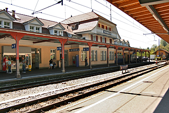
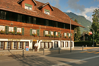
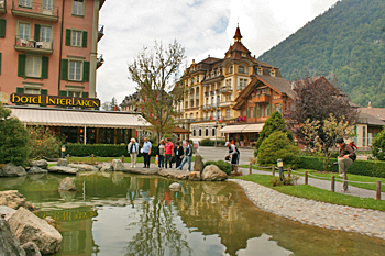
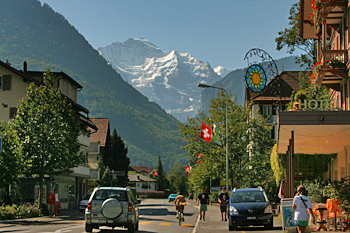
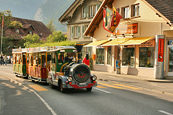
As small as it is, Interlaken has two train stations, Interlaken Ost (East), the main station, and Interlaken West. I arrived at Ost and, although my hotel was closer to the West station, I opted to walk rather than bother with transferring trains, as nothing is very far away in this small town. The Gasthof Hirschen, where I was staying, turned out to be a delightful hotel in an old, renovated chalet that included a great breakfast and free wireless internet in the price of the room. While not cheap at 100 Swiss Francs per night (about $80 US), it was reasonable compared with all the other options available to me, unless I wanted to be in a dorm with 15 other kids. The hotel was also well located, only five minutes from the Hohe Matte, or High Meadow, the town square that is famous for its view to the snow covered Jungfrau peaks.
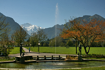
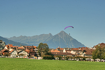
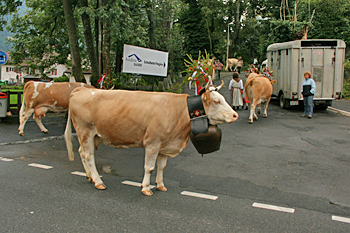
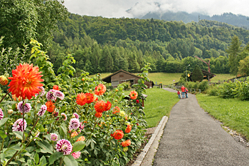
On my first full day in town I started at the Hohe Matte, where I watched the paragliders land after jumping off the nearby mountains. I could not believe how softly they landed – they literally fluttered down – and I began to think seriously about making this jump myself. In the end I ran out of time, but I may just do it at some point. Other than the paragliders, probably the most exciting thing I saw in Interlaken was a herd of cows being driven through town, their moos mingling with the sounds of the monstrous cowbells tied around their necks.
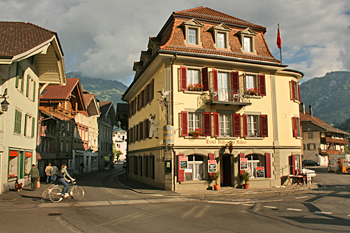
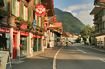
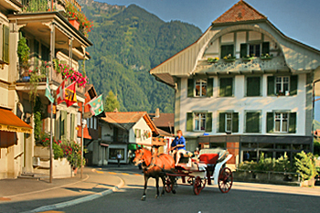
Once you have seen the Hohe Matte and checked out some of the historic old buildings, there is not much else to do in Interlaken. It is more of a central staging area for trips up into the mountains or to the lakes. I could have taken a trolley ride around town or climbed aboard a horse drawn carriage or a tour, but those things don’t really interest me.
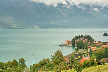
Instead, since the weather was gray and cloudy, obscuring the mountains, I decided to stay in the valley and hike part way around Lake Brienz. I started along the shores of the River Aare, which runs between the two lakes, and headed east, back the way I had come on the train the day before, although this time on the south shore of the lake as opposed to the north. A couple of miles later, where the river fed into the lake, I passed the town of Bonigen, famous for its wood carved houses that feature lavish carvings and painting dating from 1549. Not much was happening here, so I kept going. About four hours later the path inclined steeply from the shore, continuing to rise for about a mile. Finally I crested the hill and was treated to a view down to the village, it’s central business area and wharf jutting out into the lake on a small finger peninsula.
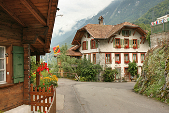
I continued on down the hill, walking past dozens of adorable chalets with carved shutters and flower boxes full of gardenias, quaint churches, scores of tidy little flower and vegetable gardens, and the prettiest lake shore I’ve ever seen.
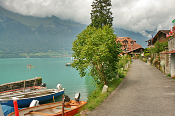
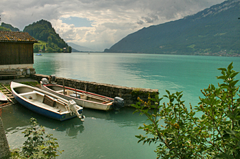

This sleepy little village is virtually undiscovered. One man was fishing from the shore, another from a rowboat a short distance from shore. A few people were strolling around the village. Several more were enjoying lunch or waiting for the next ferry boat. But compared to Interlaken, with its droves of people, Iseltwald was almost deserted. I call it an undiscovered gem, because it offers some of the finest access to hiking into the surrounding mountains of any of the towns in the area.
Tired by now, I caught the ferry back to Interlaken and watched, contented, as the sky began to clear up and a bit of blue peeked through the clouds, turning the lake water to a brilliant seafoam green in the wake of the boat.

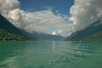
For the next two days I am headed up into the mountains of the Bernese Oberland, which are said to be spectacularly beautiful, although I have yet to see one square inch of this country that is not spectacularly beautiful. It’s hard to believe anything could top the sights I’ve seen so far in Switzerland.
Dear Barbara
Interlaken has a beautiful Youth Hostel which won several prizes for its architecture and interior. (http://www.youthhostel.ch/en/hostels/interlaken) it was built in 2011.
not to be missed. As a Swiss I always choose to stay there. The staff is really great, food is good, location perfect right next to Interlaken Ost train station.
as to the cows herding through town:
you wrote this early August. so I cannot really make out whether the event and your date go together. here in Switzerland we normally do not chase cows through town beautifully decorated with flowers and the expensive bells.
The picture is so small that I cannot make out what kind of costume the woman with the child is wearing. It was definitely a special event that you unfortunatley did not know about.
In spring farmers bring their animals up to the alp for summer. In fall, before winter sets in they bring the animals back down. This is called Alpaufzug, resp. Alpabzug. It is a big event. The farmers pride themselves to decorate their animals with flowers.
That’s really interesting Catherine. My blog posts usually run 6-8 weeks behind my actual location, so it was likely some time in Jne (can’t remember). But I remember how astonished I was by the sight, and how grateful I was to have experienced it.
I love Switzerland but haven’t spent enough time there. Alpine villages, lakes, and mountain towns are some of my favorite places in the world. I love to explore, hike, and just wander. Places like this calm my soul and slow me down. I haven’t been to Interlaken but have been to other places in Switzerland that are as beautiful and picturesque. This makes me long for Spring!